Merripit Barn and Dartmoor: Writing from an old map

I build my Steam Highwayman open-world gamebooks from the map upwards. Since discovering the National Library of Scotland’s georeferenced historical maps, I’ve used the OS six-inch 1888-1913 as inspiration and reference, and for the last couple of weeks I’ve been poring over Dartmoor.

It’s a place of legend and myth, prehistory and geology, industrial archaeology and military remains. There’s simply too much of interest to include everything in Steam Highwayman IV: The Princes of the West.

So I’ve begun by creating the navigational network underneath the events. This means planning and writing around eight key locations that are linked together to represent the vast expanse of Dartmoor itself. However, things become more complicated following that.

I don’t mean for the reader to simply be able to steam up onto the hill and tear about: Dartmoor is too treacherous for that. Neither do I want a constant series of MOTORING checks – particularly as the skills of riding a heavy velosteam over the moor, navigating across the various watersheds and steaming over the uneven ground are unlike the classic road-focussed skills I normally represent with that attribute. So instead I’m using secret links and tickboxes: on the first arrival at some of these locations, details are given about them. Returning to that passage, the book will presume that the reader knows what is going on and where they are… if you remember! After exploring for long enough, you may even be able to gain a knowledge of Dartmoor good enough to unlock secret routes across it, opening up much greater options for fast travel and getaway.

But I’m still leaving space for events and quests to happen here. Perhaps a certain glow-muzzled dog might track you in the mist, or one of the several stone circles prove to hold more than moonlit grass within it. But these can come later. For now, the navigation has to work and then onto this backing the extra events can be embroidered. I’m toying with the idea of using visible options unlocked by a variety of common-to-rare possessions.

One knot of passages is formed by the base you can build at Merripit Barn. Hideouts are going to be ever more important in SH4, and having one tucked away in the west may be just what you need. Some of the options here are generic, sending the reader off into what Brian Hazzard called a ‘subroutine’ loop when he interviewed me about this some time ago (warning: contains unpopular opinions about the repetitive nature of Fantasy gamebooks!). And these are crucial to preventing bloat within the gamebook while allowing the game part to really flourish – essentially the idea that you should be able to do the same thing at different locations. At Merripit Barn you can rest, treat your wounds, mend your velosteam, train your pet raven and all the other things a self-respecting road pirate does on their day off.

And Merripit Barn is just the right place at the right time: I needed a location that was on the edge of a location on the edge of Dartmoor, isolated but only a turn or two from one of my busier routes. Some time poring over the NLS’s maps and I found what I needed.

I’m hoping that before publishing SH4 I’ll have a good chance to revisit Cornwall and West Devon – and if I do, I’ll go and see what is actually going on at Merripit Barn.

If you haven’t seen the video revealing the draft SH4 planning map, here it is again… this time, with music courtesy of  @ramonsole5729  and Cubus Games.

The Gormley-Watt Velosteamer’s Touring Guide

I loved making the maps for my recent Kickstarter. They took a lot of time, but they were worth it. Now all fans of the series can get their hands on them!

The idea of the maps began as enlargened versions of the maps found at the front of Smog and Ambuscade and Highways and Holloways. These were originally based on Ordnance Survey maps of the area I used to live in – bought from the WHSmith on Marlow High Street – but had been drawn with the interests of my gamebooks in mind and were, to massively understate it, simplified. If I had merely scaled these up, they would have looked clumsy and dull, and some readers had already suggested improvements to the maps.

On top of this, I needed to make a fresh map for The Reeking Metropolis. The process for that was to use a digital copy of a 1:1056 Ordnance Survey map series of London published in the 1890s and to digitally trace it on an ipad Pro. I learned a fair amount in the process and so I decided to do a similar thing with the historic maps of the regions in which my first two books were set.

Tracing can be a very meditative job, and between January and March I spent many an evening drawing away. I had actually begun the job long before, but had restarted a number of times and the maps begun in January became my final ones. Colouring could be done in the ipad, but lettering was added in Microsoft Publisher (2007 edition!)

I promised a Guide Booklet as a stretch goal for my project. This was really fun to do: the cover image is a development of the Ferguson schematic I made back in 2017 for Smog and Ambuscade, together with some styling mimicked from early 20th-century bike and motoring maps. The contents took a little while to get right: I had to check through the three books fairly carefully and make sure the beer tally was correct, as well as referencing plot points for many of the pubs.

My plan of assembling and printing the guides was set long before I had final versions. Essentially, this was an exercise in mimicry once again: I set out to make something resembling The Streets of Ankh-Morpork and the Discworld Mapp. So the final order for my printer in Southend was 250 A5 booklet folders with pockets, 250 stapled guidebooks and 250 of three A2 colour posters (the three maps).

The guidebooks came in two boxes; the folders in seven and the three posters each came in a whopping A2 flatpack. They took up a corner in our living room for several months (I still have three boxes now as I write this) as Cheryl and I folded and folded and folded. Then we had to stick the guidebooks into the folders with double-sided sticky tape and tuck a set of maps into the pocket. It turned out that the printers had sent us far more than 250 of each of the maps, but exactly 250 of the guidebooks and folders, so there were going to be enough for the backers who had pledged for them, about 70 full sets left over and then around 120 sets of just the three maps.

The final product is really neat. I’m not a graphic designer by any means, but I have spent my entire life in books and printed materials, so I’m fairly savvy at putting something like this together. In some ways, it reminds me of the nonsense post my brothers and sisters and I used to send each other during long summer holidays in a family postbox, demanding prompt payment of invoices or offering spurious and over-priced correspondence courses, such as the Sternly-Blythe School of Pachydermalinguistics. Double-barrelled names do possess such a weight of Englishness, don’t they?

You can order the guidebook and maps, should they still be in stock (or possibly reprinted) here.

Every Book Needs a Map

And this is my best attempt yet at drawing out a legible, useful and atmospheric map for The Reeking Metropolis – out by the end of the year.

One thing I love about maps is the density of information – but that is also one of the things that makes them hard to create! This is very heavily based on the Ordnance Survey 1885-1900 One Inch map of London, available online courtesy of the National Library of Scotland. It’s not a copy or a screenshot, but a digital tracing, with my own exaggeration of the most important routes through the city for a desperate velosteamer.

It also includes my first attempt at using icons for several of the most important locations. Yes, I did begin with the pubs (which are almost completely written).

I had made a few prior attempts, but this seems to work because of the negative space around the irregular city ‘blocks’, which indicates the main roads and gives an impression of a much more complex city. Once again, like with every volume I’ve written so far, I’ve realised that I could have chosen a much smaller area for the reader to explore and still had a jam-packed book. So be it: I guess everyone writing open-world gamebooks (all 2/3 of us currently?) must feel like this. @Paul Gresty? @Oliver Hulme?

Anyway, I’d love some feedback from readers of Steam Highwayman. What works for you with the current maps in Smog and Ambuscade and Highways and Holloways? I’ve received some criticisms that these need more labels. Do you agree? Does every location – small and large – need to be identified on the map? Is that what you want in a map? And then, if you’re a backer who pledged for the large maps, do you feel the same? Please give me your views. Perhaps you have some specific critiques of the map above – or something that you think has to be included?

The Highwayman Afloat

Why does Steam Highwayman feature a parallel, water-borne adventure?  In Book 1, Smog and Ambuscade, around 150 passages out of the total 1017 are devoted to your options to take to the River Thames and captain your own steam barge, shipping freight and discovering unique adventures.

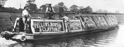
Because I love narrowboats.  I love everything about them and their history, their lore, the short-lived and much-romaticised ‘traditional’ life of the bargee families.  When I was designing my alternate but plausible steampunk past, I could not see how a Britain dependent upon steam power but lacking large railways (one of my premises) would work without some reference to the canal network at least.  In out timeline, water-borne freight on the Thames has always remained competitive with the railways, and to some extent, the roads.  Boats still lug building materials, hardcore, sewage and waste up and down the old river daily.

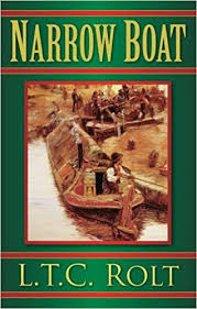
One of my regularly re-read books is LTC Rolt’s Narrow Boat.  Essentially, he was the first canal tourist and also responsible for a lot of our modern romanticised view of the canals, but he was also a writer with a real interest in the genuine traditions of the canal people.  I bought this some time back in 2010, I think, on a canal holiday with a good friend and his family.

When I lived in Marlow, between 2008 and 20012, I got to know the reach between Maidenhead and Henley very well.  I had only been afloat on it a handful of times, but I was fascinated by the boathouses and bridges and could see how a highwayman adventuring back and forth across this great boundary would have to interact with its people and way of life.  I had walked the towpath between Marlow and Henley in sun, rain and the dead of night.

Writing a continuation and development of the river into Book 2, Highways and Holloways, I’ve had to make some decisions.  I’m currently trying to smooth out the reader’s journey to include fewer repetitions and more story.  There should still be the opportunity to trade, investing relatively large amounts of capital to make good returns, all in the name of that retirement bank account at Coulters!  After all, trading (and defeating pirates) by sea in Fabled Lands was always the best way to get your hands on a pile of cash.

But I know the reach between Henley and Oxford less well.  So I’ll be depending on the good old OS171, Chris Cove-Smith’s The River Thames Book and lots of googlemaps.  Nothing can replace the insight you gain from the locations themselves however and since a very large part of my pleasure in writing the Steam Highwayman series is to share my love of the parts of these parts of the world, I think I’ve got a good excuse to take an extended walk along the Thames pretty soon.

I still live by the Thames, but much further east and I see the Thames Barrier out of window and enjoy the tides defining the rhythm of the day.  Regular shipments of estuary and Dogger-dredged aggregates are unloaded opposite our tower at Angerstein wharf – the largest gravel and sand unloading wharf of its kind Europe.  The walks along the river here are quite different – and a good subject for another time, or another book.

Two other fluvial reads I’ll recommend here are the hilarious JK Jerome’s Three Men in a Boat, which furnished me with the minimum of an amusing encounter in Smog and RL Stevenson’s An Inland Voyage.  Three Men has still got plenty to give, so I’ll be mining it in the next fortnight, whereas the Stevenson is much more down-to-earth.  I might borrow some of his cold and damp.